
Follow a Rockville Centre Street by Address
A street search works best as a chain of narrow questions. First determine which physical parcel the address represents. Then use the parcel key to inspect county assessment context, map geometry, and recorded instruments. The Nassau Section, Block, and Lot, or SBL, is the bridge between these systems. A person’s name can have variants; an address can have abbreviations. The SBL makes it easier to test whether records refer to the same land.
For a historic connection, add the date to every result. A directory may list a name at an address in one edition. A deed may name parties to a transaction on another date. Neither item, standing alone, establishes a present household. New York’s voter lookup is also not a by-street roster: it requires a known person’s name, date of birth, county, and address, and voter-file requests require an election purpose.
- Run the full physical address through the USPS ZIP Lookup and retain the returned postal form and date.
- Search Nassau Land Records Viewer, or LRV, by house number, street, Town, and ZIP. Record the Village/Town fields and SBL.
- Open Nassau GIS, identify the parcel, and note roads, rail, parks, or other visible boundaries around it.
- Search the Nassau County Clerk’s Official Land Search by SBL or address. Compare grantor, grantee, instrument type, date, and legal description before linking records.
- For a dated association, check Rockville Centre Library and NY Heritage directory or newspaper holdings. Use the edition date in the final note.
Normalize Rockville Centre Street Addresses
Postal normalization comes before a parcel search. The USPS tool accepts a street address, unit, city, state, and ZIP, and also supports city/state and ZIP searches. Its result is a delivery-format answer, not confirmation that a particular person is at the address. Keep a unit with the query when one is material. Do not use a PO Box as a parcel or street location.
Rockville Centre adds a local reason for this check. The Village Hall’s physical address uses 11570, while Village PO Box 950 uses 11571. A mailing ZIP therefore does not settle village jurisdiction or establish a physical address. After USPS, compare LRV’s Village and Town fields with the GIS place boundary. If the systems differ, preserve the difference instead of forcing one label onto each record.
Search Rockville Centre Parcels in LRV
Nassau LRV accepts either an SBL or an address. Its address screen uses house number, street name, Town, and ZIP. The county advises omitting directional prefixes and road-type suffixes when entering a street name, so a failed full-form query may merit a second, documented variant. The resulting card can display values, tax rows, property description, recent sales, district information, and a deed liber/page reference. It is an assessment record, not a statement of occupancy.
| Rockville Centre search surface | Fields or controls | Careful use |
|---|---|---|
| LRV SBL lookup | Section, Block, Lot; search and clear | Copy the exact SBL, roll year, and card URL. |
| LRV address lookup | House Number, Name of Street, Town, Zip | Document any normalized street-name variant. |
| LRV parcel card | Values, taxes, description, sales, My Nassau Info, tax class | Record the tab and year used; do not infer occupancy. |
| GIS viewer | Address search, layers, identify, distance, area, location units | Save the layer names and capture date with the parcel observation. |
| GIS REST parcel query | Where/text/object IDs, geometry, distance, output fields and format | Use saved parameters for reproducible map work, not person searching. |
The sample Rockville Centre LRV parcel card illustrates the Village, Town, school, SBL, value, tax, sale, description, and district tabs available on one public record.
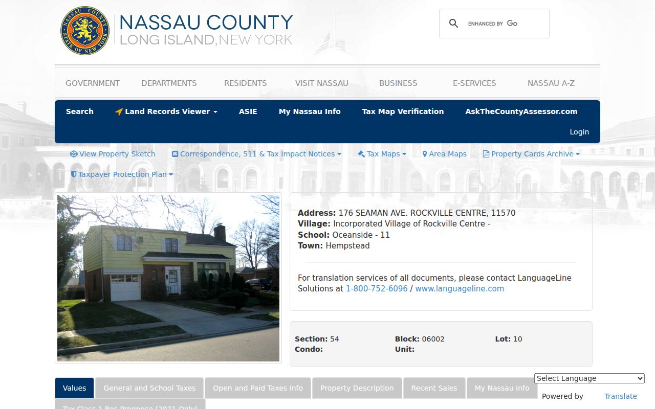
The card is a useful field guide for reading an assessment page, but its sample values and identifiers belong only to the displayed parcel. Record a roll year before comparing cards across time.
Rockville Centre Address Terms Defined
Several terms recur in a street directory search. Using them narrowly prevents an assessment or map record from being mistaken for a household record.
- Parcel
- A defined piece of land represented in assessment and map systems.
- Situs address
- The physical location used to identify the parcel. It can differ from a tax correspondence address.
- SBL
- Section, Block, and Lot, Nassau County’s parcel key for linking an address to land records.
- Plat or subdivision map
- A recorded map that shows lot layout, roads, and divisions at a stated time.
- Criss-cross directory
- A historical directory arranged by address or telephone, useful only as a dated listing.
Keep the property term and the person term separate. A parcel can be mapped and a recorded party can be named without establishing who occupied a structure at any later date.
Rockville Centre Street Record Coverage
Address-keyed records answer different parts of a street question. LRV and GIS establish the parcel. The Clerk records instruments against land. Building files may document a construction event. The library preserves dated local material. A result should use the verb that matches its source, such as “the deed names,” “the directory lists,” or “the map labels.”
| Address record | Rockville Centre keeper | What it can show | Access route |
|---|---|---|---|
| Assessment parcel card | Nassau Assessment/LRV | SBL, address, village/town, class, roll values, taxes, sales, and description | Online LRV; CAPTCHA or account behavior may apply |
| Parcel geometry | Nassau GIS | Lots, roads, rail, parks, boundaries, aerial and historic layers | Online viewer and REST service |
| Recorded instruments | Nassau County Clerk | Grantor/grantee, instrument, date, document number, and legal description | Official Land Search, Clerk office, or request route |
| Permit or certificate file | RVC Building Department | Construction, alteration, completion, licensed work, and code events | Department or Village FOIL request; no public permit search located |
| Historic map, directory, newspaper | RVC Public Library and NY Heritage | Dated address association, map detail, and local event context | Digital collection, reference desk, or archive; holdings have gaps |
The key sequence is address to SBL, SBL to parcel card and map, then SBL or address to the Clerk index. The Clerk’s Office at 240 Old Country Road in Mineola holds land records, while the Village Building Department handles its own address files. Request a specific permit, certificate, or date range instead of asking for a generalized street roster.
Trace Rockville Centre Deed Entries
The Nassau County Clerk’s Official Land Search is the instrument layer for deeds, mortgages, maps, assignments, and related recordings. Search is free. The portal shows online images from February 22, 1994 forward, with earlier images added periodically; Nassau’s land registry itself reaches back to 1899. The difference matters. A missing download image is not proof that an older deed does not exist.
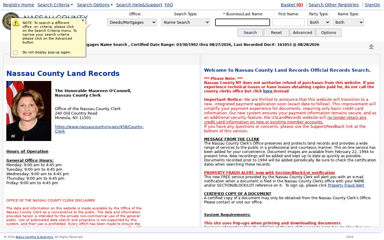
The search page is where a parcel inquiry moves from assessment context to recorded instruments. Save the exact criteria, document or liber/page number, instrument type, recording date, named party roles, legal description, image availability, and certification status. Downloads are listed at $0.65 per page, while certified copies come through the Clerk rather than an assumed portal printout.
Land documents may be e-recorded, mailed or delivered, placed in the lobby drop box, or brought to the Clerk. For an older or unavailable item, the office and document-request routes are the fallback. A chain becomes more reliable when grantor and grantee roles, instrument type, date, and parcel description agree across each link.
Map Rockville Centre Street Context
Nassau GIS provides parcel and lot geometry along with road annotations, railroads, major roadways, parks, place boundaries, aerials, FEMA layers, and historic county layers. Use Identify on the target parcel, then record adjacent SBLs and whether a road, railroad, park, water feature, or right-of-way separates polygons. A map can establish adjacency at the displayed date. It cannot establish a social relationship or a current household.
For the immediate parcels around one address, the Rockville Centre neighbors lookup keeps the method focused on adjacent polygons. A whole-street inquiry should still stop at what the interface and lawful records support. The reviewed GIS tools did not provide a public current resident-list export or a dedicated all-neighbors-within-a-radius search.
Rockville Centre Streets Across Map Layers
Historic context helps explain why a modern address can look unfamiliar in an older record. The Nassau GIS viewer includes 1926 and 1950 historic county layers. Compare the current parcel shape, road alignment, and rail relationship against each selected layer, then record the layer name and capture date. It is safer to say a lot appears adjacent on a displayed layer than to treat GIS as a survey.
The local rail story is also useful orientation. The railroad arrived in 1867. By 1925, the Long Island Rail Road ran at ground level through downtown; later elevation and parking fields changed the landmarks around downtown addresses. Use that history to interpret a dated map or newspaper description, not to invent a missing street-number conversion.
Use Rockville Centre’s 1906 Map Grid
The NY Heritage Rockville Centre map collection contains 1906 sheets organized by rows and columns, with identifiers such as L_1_A. Record the sheet identifier, old street or lot label, nearby landmark, and map date. Then locate the present parcel in LRV and compare that SBL with Clerk maps or instruments when a subdivision or road change is suspected.
The 1906 sheet is a historic observation, not a modern boundary or occupancy source. A strong address note can distinguish four dates: the 1906 map sheet, a later directory listing, an instrument or subdivision record, and the current LRV card.
Find Rockville Centre Streets in Dated Sources
The RVC Public Library Archives and NY Heritage telephone directories are the historical shelf for an address inquiry. Documented directory holdings include 1923–24, 1938, and 1946–57 with gaps, plus later holdings. Search both street and name variants, including “RVC,” “Rockville Centre,” and older local terms when the date calls for them. Newspapers can add an event date, but OCR should be checked against the page image.
A dated entry can support careful wording, such as “the 1938 telephone directory lists a name at this address.” It does not prove a move date, death, vacancy, or present contact information. For a directory collection’s history and access details, use the Rockville Centre Directory Book.
Limits of a Rockville Centre Street Directory
There is no official all-residents directory for Rockville Centre. An LRV card may contain a tax mailing address separate from the physical situs, and the public card does not establish a general owner-name directory. GIS geometry does not identify occupants. Building permits can contain applicant or contractor information that may need redaction. Library circulation and similar records are confidential under New York CPLR §4509.
Address Confidentiality Program participants can use a substitute mailing address, and confidential voter registrations are separately protected. A missing result can be a privacy safeguard, a date mismatch, or a search-form issue. It is not evidence that a person is absent from the community.
Lawful use. Use Rockville Centre street records for limited, personal, lawful research and keep claims at the parcel or dated-source level. New York stalking and harassment laws prohibit conduct that uses personal details to cause fear, harm, harassment, or unwanted contact.